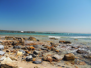
I still hope to write Not Your Usual Rocks, so we went off looking for petrified trees. There were two lots that I had read about, around Lake Macquarie, and I managed to find both sites. The Blackall Park one, however, was hard, and the area is so pillaged that I won't say how to get there: if you have a special need, contact me with an email address for a reply with how-to-get-there details.

 This item on the left was in the area: I suspect some joker was playing games. It is NOT what we were seeking.
On the right, you can see the real thing, as viewed at high tide.
And here is the same thing, seen at low tide. When the Reverend W. B. Clarke recorded these in the 1840s, there were 500, while in the 1970s, there were said to be 30 (the rest had been "souvenired").
We found just two. This is not a Good Thing.
I found Clarke's description of the area, which he calls by its local name of Kurrur-kurran, in the The Sydney Morning
Herald, 4 August 1845, p. 2, which you can jump to from this link. In that same article, he mentions another site, at what is now Swansea Heads, and I will explain how to get to that one.
 First up, choose a time of low tide. We went back on our last day to see what was visible of the "petrified trees", and it was nearly all under water.
Like this picture at the right.
But at low tide, there are some marvellous remnants to be seen. In the shots that follow, there is an Australian 50-cent coin for scale: this is 37 mm (1.5 inches in primitive countries) .
To get there, drive towards Swansea, take a left towards Caves Beach, but pick up Northcote Avenue, then Lambton Parade and park at the end in the Reid's Reserve car park. Find a track through the dune to a beach on the east (it's very sheltered by a reef, so often has lots of children and dogs). Go to the water's edge, swing right and head around, out onto the rock platform.
Then look for these:
Well, if that doesn't ring your bell, forget it, but there's something else to look for, liesegang markings.
The cliff at the back of the platform is part of the Reid's Mistake Formation. This is a tuffaceous sandstone with pronounced jointing and amazing folding.
Over the millennia, water has seeped through the joints, and soaked into the rock, producing these patterns. First, here is a ranging shot to show you where to go: from this part of the cliff, turn left and go along the concrete (there's some sort of drain there), until you get to here:
Now move in and look for things like this:
The first one (above) is rock covered by water. The second one (below) is dry.
The last two are also dry, but I have loaded these as hi-res. Try clicking on them.
And please, enjoy!
Notes
I have just found a few useful side bits in Wikipedia under
There are probably other leads as well, if you search on "Kurrur Kurran", but the first of these links tells us what happened to some of the missing material.
January 3, 2016: I am working on this title. I don't like it much at the moment, but that usually happens with my books. I fix the unlikable bits before anybody else sees them. It needs a new chapter 1.
January 3, 2016: I am working on this title. I don't like it much at the moment, but that usually happens with my books. I fix the unlikable bits before anybody else sees them. It needs a new chapter 1.


No comments:
Post a Comment